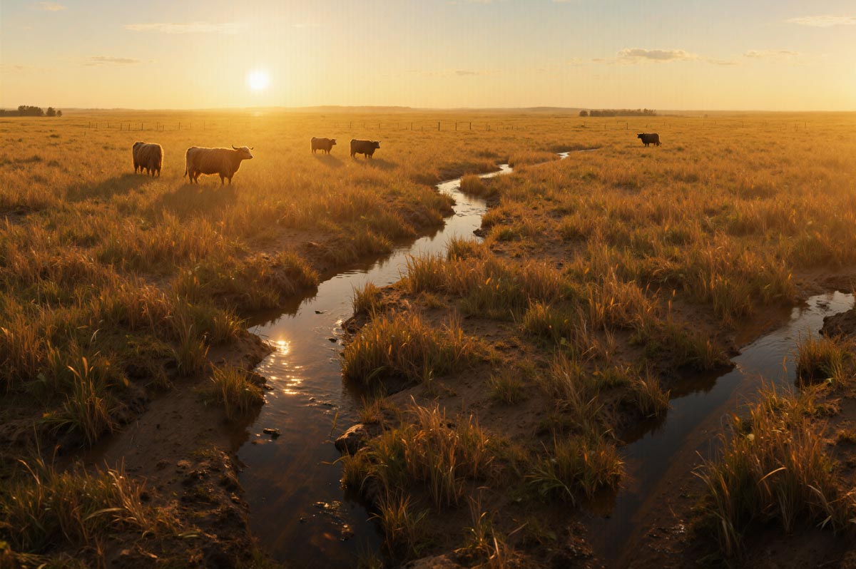
Grazing · Recreation · Grasslands · Public Access
Stop Industrial Solar on Tunkwa's Working Lands
Public land. Private ownership. Public pays.
If Crown land is tied up for decades for a privately owned utility project, the public deserves transparency, fair compensation for affected residents and ranchers, and cleanup security paid up front.
The Community Has Spoken
The official engagement record confirms serious concerns about the proposed solar project's location, scale, water impacts, wildlife disruption, grazing conflicts, access restrictions, and cumulative industrial pressure on the Tunkwa–Logan Lake area.
View the Submissions OverviewThis is an independent public-interest campaign website. It is not operated by the Government of British Columbia, the Environmental Assessment Office, BC Hydro, or any local government, and it is not funded by oil companies or corporate interests.
Take Action Now
This project is currently in the Environmental Assessment process. Public input matters — and decisions are being shaped right now.
Get Updates on This Campaign
Early engagement is critical. Once approvals advance, opportunities to influence the outcome become limited.
Based on project area and typical utility-scale solar infrastructure. Final footprint and material totals subject to project design.

Outlined areas are approximate and represent the broader industrialization of prime ranchland and active grazing tenure. This map likely represents only a portion of projects currently in development across the region.
Most of the public has no idea these projects are converging on the same landscape at the same time.
This Is Bigger Than One Project
The Tunkwa solar proposal is not an isolated case. Multiple industrial-scale solar projects, a massive wind farm, pipeline expansions, and mining operations are all converging on the same rural landscape — driven in part by BC Hydro's Call for Power.
- Multiple solar projects and the Highland Valley Wind Farm are targeting the same corridor of ranchland and grassland
- Pipeline expansions and mining operations add further industrial pressure to the region
- No single review process accounts for the combined impact on wildlife habitat, rural roads, and the character of this area
Why This Matters
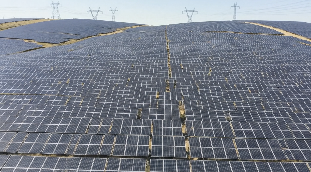
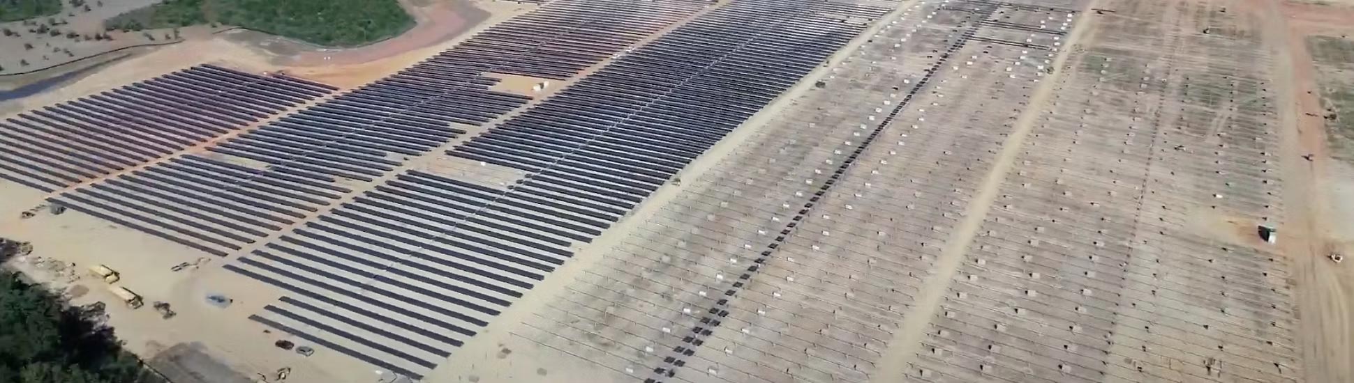
This is not a small or incidental land-use change. Based on the current two-phase proposal under assessment, m.ah a temEEwuh would total 208 MW across approximately 776 hectares — an area roughly equivalent to more than 1,400 football fields. That would make it about 14 times larger than BC's current largest utility-scale solar facility.
A Scale BC Has Not Yet Seen
This is not just another small renewable project. The current proposal combines two phases — 104 MW AC each — into a single 208 MW development assessed together, covering approximately 776 hectares of Crown land. That represents solar development at a scale not previously seen in British Columbia.
Projects of this size do more than change one site — they can set expectations and precedent for how much ranchland and rural landscape may be considered available for future industrial solar development. Once a project of this scale is normalized in this landscape, it may become easier for other large industrial renewable projects to follow.
For local residents, ranchers, and recreation users, the question is not only what happens on this one footprint, but what this scale of approval could mean for the broader future of BC's grasslands and ranchlands. That is why cumulative effects, precedent, land-use change, and long-term regional planning matter now — not later.
The final disturbed footprint may be less than the full 776-hectare project area, but even a reduced footprint represents a large-scale industrial conversion of working grasslands, off-road trails, hunting grounds, and recreational areas.
Permanent Land-Use Change
A 25–40+ year industrial footprint effectively removes this Crown land from public use for a generation or more.
Wildlife Habitat Disruption
Fencing and industrial activity fragment corridors used by deer, elk, raptors, and grassland-dependent species.
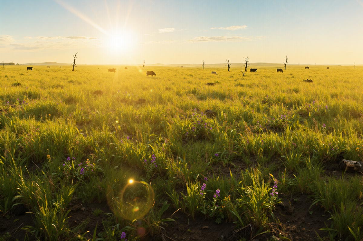
Industrialization of Natural Grasslands
Native bunchgrass ecosystems — among BC's most endangered habitats — would be cleared for panels, roads, and electrical infrastructure.
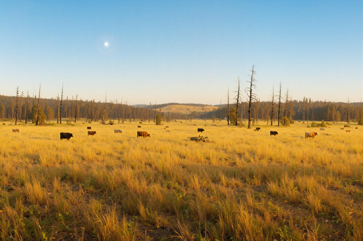
Loss of Grazing & Ranching Use
Approximately 1,000 acres of active Crown range would be fenced and converted, displacing multigenerational ranching operations.
Most of the Public Has No Idea This Is Happening
The Tunkwa area is one of the few regions in British Columbia where proximity to existing transmission infrastructure, available Crown land, and favourable solar and wind exposure converge. That combination has made it a target for an unusual concentration of industrial energy development — but almost none of this activity is widely known outside the immediate area.
Without broader public awareness, decisions about how this landscape is used for the next 25 to 40 years will be shaped by a small number of project proponents and agencies — with limited input from the communities, recreationists, and ranchers who depend on it. The window for meaningful public engagement is narrow, and once approvals advance, the opportunity to influence outcomes becomes materially limited.
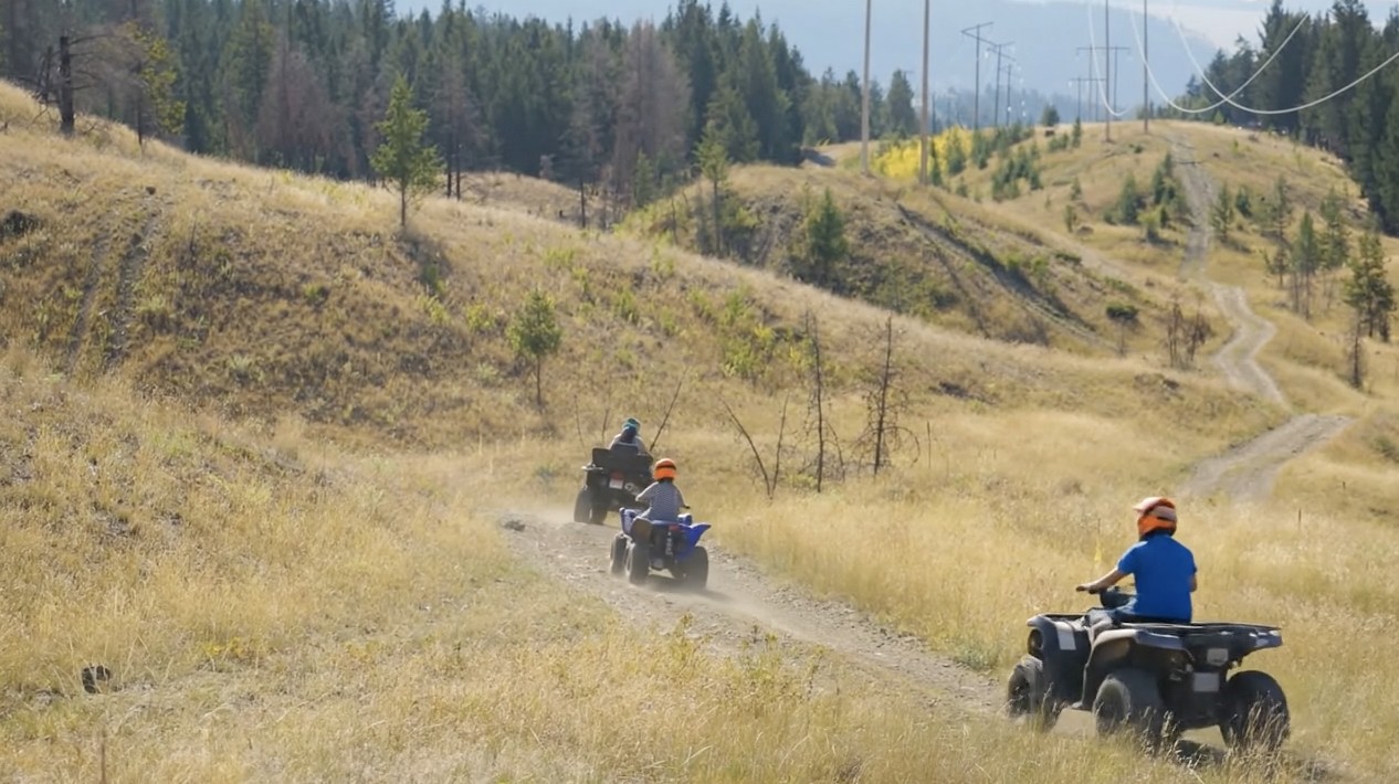
Trail Access
Community forest trails used by families, riders, and recreationists today — replaced by fenced industrial solar infrastructure tomorrow.
 Today
TodayCommunity Access & Recreation
Open trails, ATV riding, hiking, and family recreation on post-wildfire recovering land that the community actively uses and values.
 After Industrial Solar
Fenced Industrial Infrastructure
Perimeter fencing, restricted access, and industrial panels stretching across the landscape — for approximately 30 years through ~2060.
Once this land is converted, community access is gone for a generation.
The developer has indicated they will consider accommodating some trails. However, the Initial Project Description shows panels directly on top of the major access route out of town — meaning access to the broader recreation area would be fundamentally impacted regardless of individual trail adjustments.
Trails, riding areas, and recreation access that families depend on would be replaced by fenced industrial infrastructure. This is not a temporary disruption — it's a 30-year commitment that fundamentally changes how this community forest land is used.
Volunteer to Help Protect Tunkwa
This campaign needs practical local support from people who care about grasslands, grazing, recreation, access, hunting, fishing, camping, trail use, and the long-term future of the Tunkwa area.
Our Most Important Volunteer Needs Right Now
Our first priority is to quickly build awareness in the community.
Door-to-Door Flyer Delivery
Help distribute campaign flyers to homes, rural properties, nearby communities, and key locations so more people understand what is being proposed and how to get involved.
Social Media Posting
Help share campaign updates, key facts, meeting notices, graphics, and website links through Facebook groups, community pages, and personal networks.
Additional Ways to Help
Sign Up to Volunteer
Fill out the form below and we'll connect you with volunteer opportunities.
Community-organized. Independent. Local.
This Area Is Recovering From a Major Wildfire
The project area was significantly impacted by the 2021 Tremont Creek wildfire. The land is now in a recovery phase — not a mature, undisturbed forest.
This is not untouched forest — it is a recovering landscape that should not be permanently converted into industrial infrastructure.
This makes how the land is used moving forward even more important. A recovering landscape needs thoughtful stewardship, not permanent industrial conversion.
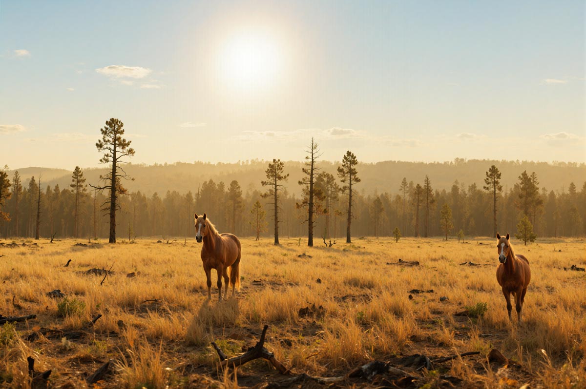
This recovering landscape also supports active ranching, the Lower Nicola Indian Band, rural farms, recreation, and diverse animal populations including wild horses — all of which depend on water systems such as Guichon Creek, making its future use critically important.
Guichon Creek Supports More Than Ranching — It Is Not Seasonal
Guichon Creek is relied on as a consistent water source for livestock, the Lower Nicola Indian Band, rural farms, recreation, and diverse animal populations including wild horses. Local experience shows it does not simply dry up, making its accurate classification critical to this assessment.
Project Scale: What Is Actually Being Proposed
This is one of the largest industrial solar developments proposed in the region. Even a reduced footprint represents a large-scale industrial conversion of working grasslands.
At this scale, the project involves large volumes of panels, steel racking, cabling, transformers, and supporting infrastructure.
Even conservative estimates indicate tens of thousands of tonnes of material over the project lifecycle, including more than 20,000 tonnes of panel material alone.
At this scale, even small failure rates create significant environmental impact.
A 1% panel failure rate across hundreds of thousands of units means thousands of damaged panels requiring managed disposal, each containing industrial materials.
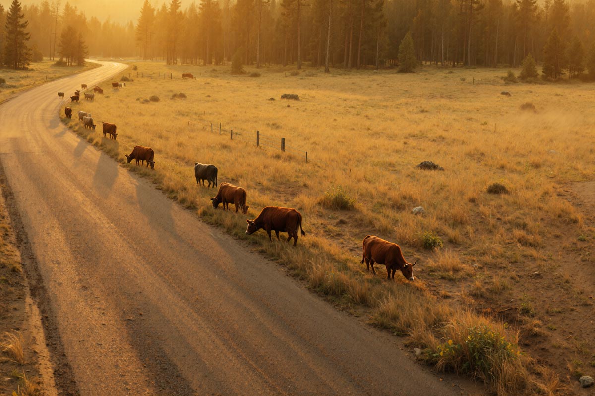
Ranching: Food Security & Land Stewardship
Crown range tenures in the Tunkwa Valley support working landscapes that produce food, maintain ecosystems, and sustain rural communities.
Water & Land Management
Ranchers maintain water sources, manage fuel loads, and sustain open rangeland that benefits the broader ecosystem.
Stewardship at Private Risk
Crown range tenure holders invest personal resources to maintain public land — benefits shared by all users.
Local Food Production
Independent producers contributing to BC's food security and rural economic resilience.
Community Economic Base
Veterinary services, equipment suppliers, feed stores, and seasonal employment depend on active ranching.
Same Land. Same Reason. Different Purpose.
The south-facing grasslands that make this site ideal for solar energy are the same grasslands that make it prime rangeland. These slopes maximize sun exposure — which grows the forage ranchers depend on. This is not a coincidence. The company wants this land for the exact same reason ranchers have used it for generations.
No Co-Grazing. Total Exclusion.
The company has stated at previous public meetings that cattle and wildlife would be totally fenced out of the facility. This is not an agrivoltaics scenario — ranching and wildlife would be permanently displaced from this land.
Working Crown land is conservation land — managed by the people who depend on it.
This recovering post-wildfire landscape supports active ranching, the Lower Nicola Indian Band, rural farms, recreation, and diverse animal populations including wild horses — all connected to water systems such as Guichon Creek, making its future use critically important.
The Energy Math
Key metrics for evaluating the trade-off between land use and energy output.
Seasonal Variation
At BC's latitude, winter solar output drops significantly due to shorter days, lower sun angles, and snow cover. BC's electricity demand peaks during cold, dark evenings — when solar generation is near zero.
Storage & Grid Integration
Surplus summer energy cannot be efficiently stored for winter at utility scale. Battery storage remains costly and adds its own environmental considerations, making seasonal storage impractical at present.
208 MW on Paper Is Not 208 MW in Reality
Understanding the difference between rated capacity and actual energy delivered.
Nameplate vs. Actual Output
A 208 MW nameplate rating (proposed in two 104 MW phases) represents peak theoretical output under ideal laboratory conditions. Real-world performance depends on sunlight intensity, angle, temperature, and equipment losses — delivering a fraction of rated capacity on average.
Weather, Season & Time-of-Day
Solar output varies with cloud cover, season, and time of day. In interior BC, winter days are short and sun angles are low. Output can drop 70–80% compared to peak summer months, with zero generation at night.
Winter Mismatch in BC
British Columbia's electricity demand peaks in winter — during cold, dark evenings. Solar generation peaks in summer midday. This seasonal mismatch means solar cannot reliably serve the periods of highest need without large-scale storage.
Key Takeaway
Projects should be evaluated based on reliable delivered energy, not nameplate ratings. Public land-use decisions deserve analysis grounded in real-world performance data.
Real-World Solar Case Studies
Utility-scale solar facilities have faced significant real-world challenges worth examining. These are not small renewable installations — they are large industrial land conversions.
Ivanpah, California
- ●High-profile concentrating solar facility on federal land
- ●Ongoing cost and performance concerns since opening
- ●Utility contracts reconsidered due to underperformance
Crescent Dunes / Tonopah, Nevada
- ●Utility-scale solar facility with molten salt storage
- ●Repeated technical failures and prolonged shutdowns
- ●Developer filed for bankruptcy; public financial exposure
End-of-Life Reality
- ●Panel disposal costs rising as early installations age
- ●Recycling infrastructure remains limited and costly
- ●Long-term site restoration poses unresolved challenges
Tunkwa Lake Road Could Face 10× to 25× Today's Traffic
Tunkwa Lake Road is a low-volume rural access road serving ranchers, recreation users, and visitors to Tunkwa Provincial Park. Construction of a 208 MW industrial solar development could change that dramatically.
900%
Low-End Increase
Over current traffic
2,400%
High-End Increase
Over current traffic
10×
Low-End Scenario
Today's traffic volume
25×
High-End Scenario
Today's traffic volume
On a road that may currently see only about 200 vehicle passes per day, adding 2,000 to 5,000 daily passes would not be a minor increase — it would be a dramatic shift in how the road functions. At the low end, that is roughly 10 times today's traffic. At the high end, it is 25 times current traffic.
Traffic Comparison at a Glance
| Scenario | Daily Passes | Increase | In Plain Terms |
|---|---|---|---|
| Current Estimated Traffic | ~200 | — | Baseline |
| Low-End Construction Scenario | 2,000 | 900% | 10× current traffic |
| High-End Construction Scenario | 5,000 | 2,400% | 25× current traffic |
Note: The current 200 daily passes figure is a conservative estimate based on baseline rural traffic conditions. Construction traffic scenarios are derived from documented comparable solar project data scaled to the proposed project size.
Why This Matters
This is not a small increase or a normal fluctuation. It would represent a fundamental change to a road used daily by:
- Local residents
- Ranching operations
- Recreation users
- Hunters and anglers
- Campers and families
- Off-road and backcountry users
Higher traffic volumes would change Tunkwa Lake Road from a low-volume rural route into a much more industrialized corridor. This raises serious concerns around road safety, dust, noise, livestock movement, recreation access, and the overall experience for visitors and residents alike.
Even the low-end estimate would be extreme.
A 900% increase — 10 times today's traffic — would be highly significant for a road like Tunkwa Lake Road. The high-end scenario of 2,400% — 25 times current traffic — would represent a complete transformation of the corridor's function and feel.
This Corridor Deserves a Full Review
Before Tunkwa Lake Road is treated like an industrial access route, the public deserves a full and honest review of what that level of traffic would mean for safety, access, livestock, recreation, and the long-term character of the Tunkwa area.
Industrial Traffic Does Not Belong at Tunkwa
Tunkwa Lake Road serves a provincial park, a ranching landscape, and some of the most popular backcountry recreation in the BC Interior. It is not an industrial transport corridor.
What Comparable Solar Construction Traffic Can Look Like
A documented 20 MW solar project estimated approximately 284 two-way vehicle trips per day at peak construction. The proposed m.ah a temEEwuh project is up to 208 MW across two phases — roughly 10 times larger.
Scaled proportionally, that could mean in the range of 2,840 two-way vehicle trips per day at peak construction — a staggering volume of heavy industrial traffic on a rural road that serves a provincial park, active ranch land, and backcountry recreation.
That kind of traffic volume would jam access and radically change the feel and function of this recreation corridor.
Important context: The 284 trip figure is drawn from public documentation for a separate, smaller 20 MW solar project and is used here only as an illustrative reference point. Actual traffic volumes for the proposed 208 MW project have not been publicly disclosed by the proponent. The scaled estimate above is a proportional projection, not a confirmed figure.
A Recreation Landscape, Not an Industrial Corridor
Tunkwa Provincial Park and the surrounding area is a major recreation destination for fishing, camping, hunting, horseback riding, wildlife viewing, hiking, canoeing, and winter recreation. This is where families camp, anglers fish, hunters pursue game, and trail riders explore open grasslands. It is not a place for heavy equipment, oversized loads, and industrial construction convoys.
Industrializing access through this corridor would jam, degrade, and restrict the uses that define this landscape. The burden would fall entirely on ordinary recreational users — hunters, campers, anglers, ATV users, trail riders, and families accessing the park.
Tunkwa Lake Road Is Park and Backcountry Access
The project documents themselves state that access to the project area is via Tunkwa Lake Road. This is the same road that provides access to Tunkwa Provincial Park, surrounding recreation areas, and active grazing tenures. It passes through sensitive grasslands, wetlands, and fish-bearing country.
The project documents also identify increased traffic and road use on Tunkwa Lake Road and access roads as a potential project effect. This is not speculation — it is acknowledged in the proponent's own materials.
"This area is for fishing, hunting, camping, riding, trail access, and backcountry recreation — not for turning Tunkwa Lake Road into an industrial corridor."
Industrial Traffic Would Jam Public Recreation Use
Tunkwa Lake Road is a rural access road. It was not designed for sustained heavy industrial traffic — oversized loads, concrete trucks, gravel haulers, crane transports, and daily crew movements. During peak construction, the volume and character of traffic would fundamentally change the experience of using this road and accessing the surrounding area.
Recreational users pulling boats, hauling ATVs, or towing horse trailers would be forced to share narrow road sections with industrial convoys. Dust, noise, delays, and safety concerns would make the area less usable, less enjoyable, and less safe for ordinary people trying to reach the park, the lake, or the backcountry.
Sensitive Areas Already Come With Restrictions
BC Parks limits ATV and vehicle access in the area to designated trails because the surrounding fish-bearing streams, wetlands, and grasslands need special protection. Nearby trail and ORV access has already faced pressure and closures related to wildfire recovery. These are not abstract environmental concerns — they are restrictions that already apply to ordinary recreational users.
If these landscapes are sensitive enough for the Province to limit ordinary public motorized use, they are the wrong place to funnel heavy industrial construction traffic for a utility-scale solar development.
More Industrial Use Means More Restrictions on Everyone Else
When industrial projects move into recreation country, the public almost always ends up with fewer freedoms and more restrictions. Construction zones bring road closures, safety setbacks, access limitations, and new rules. Operations bring permanent fencing, exclusion zones, and industrial monitoring.
The pattern is consistent: hunting access gets restricted, ORV routes get closed or narrowed, camping areas get pushed further away, and the open character of the landscape is replaced by industrial infrastructure. All the burden falls on ordinary users — hunters, campers, anglers, ATV users, trail riders, and families accessing the park.
Our Position
Tunkwa Lake Road and the surrounding recreation corridor must not be turned into an industrial access route for a utility-scale solar development. This area serves a provincial park, active grazing tenures, and some of the most important backcountry recreation in the BC Interior. Industrial construction traffic is incompatible with these uses and would impose unacceptable burdens on the public.
Park and Camping Access
Tunkwa Provincial Park is a destination for camping, fishing, canoeing, and family recreation. Industrial construction traffic on Tunkwa Lake Road would directly interfere with safe, enjoyable access to the park and surrounding campgrounds.
Hunting and ORV Use
Hunters and off-road vehicle users depend on this corridor and surrounding trail network. Industrial activity brings restrictions, closures, and safety conflicts that squeeze out the very users who have relied on this landscape for generations.
Sensitive Wetlands and Grasslands
BC Parks already limits motorized access because of fish-bearing streams, wetlands, and sensitive grasslands. If the area is too sensitive for ordinary public motorized use, it is too sensitive for heavy industrial traffic.
Heavy Construction Traffic
A documented 20 MW solar project estimated roughly 284 two-way vehicle trips per day at peak construction. The proposed project is far larger. This kind of traffic volume would radically change the feel and function of this recreation corridor.
Defend Access to Tunkwa
Oppose industrial traffic through the Tunkwa recreation corridor. Defend access to Tunkwa Provincial Park and nearby recreation areas. Protect hunting, camping, trail access, and off-road vehicle use. Demand cancellation of the project or a separate industrial access route far away from the park and recreation corridor.
Wildfire Risk Cannot Be Ignored
This region has already experienced major wildfire. Adding industrial infrastructure increases both ignition risk and damage complexity.
Proven Fire History
The 2021 Tremont Creek wildfire directly impacted this area. Interior BC grasslands and post-burn landscapes are classified as highly fire-prone.
Additional Ignition Sources
Industrial electrical infrastructure — inverters, substations, cabling across ~1,000 acres — introduces ignition risk to an already vulnerable landscape.
Infrastructure Vulnerability
Solar infrastructure cannot be protected from large-scale wildfire events. Fire damage to panels releases contained industrial materials into soil and waterways.
Compounded Cleanup
Post-fire remediation becomes significantly more complex when industrial materials — metals, wiring, damaged panels — are present across hundreds of hectares.
In a fire-prone region, long-term infrastructure must be evaluated for how it performs under wildfire conditions.
Industrial Materials & Long-Term Risk
A 208 MW industrial solar development proposed in two phases (104 MW each) introduces industrial-scale materials and infrastructure to an undeveloped landscape.
Site Preparation & Grading
Construction requires clearing native vegetation, compacting soil, and creating erosion risk across grassland within the 776-hectare area of interest. The final disturbed footprint has not yet been finalized, but even a reduced footprint represents a large-scale industrial conversion.
Wildlife Corridor Fragmentation
Security fencing and panel arrays reduce movement for deer, elk, and grassland bird species that depend on connected habitat.
Public Access Restrictions
Industrial security requirements would end open access for anglers, hunters, and recreational users of this Crown land.
Operational Maintenance Impact
Ongoing vehicle traffic, vegetation management, and equipment servicing across the site for 25–40+ years.
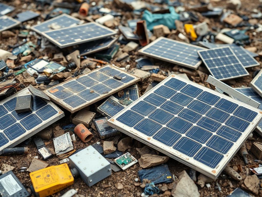
Lifecycle & Disposal Considerations
Industrial Materials at Scale
Hundreds of thousands of panels contain lead solder, cadmium compounds, and other industrial materials. At this volume, even low failure rates produce significant quantities requiring managed disposal.
Operational Risk Scenarios
Fire damage, severe weather, and aging infrastructure can compromise panel integrity. Damaged panels may release contained materials into soil and waterways over the facility's multi-decade lifespan.
Decommissioning & Waste
At end-of-life, the entire facility must be dismantled and disposed of. The International Renewable Energy Agency projects 78 million tonnes of global solar panel waste by 2050 — recycling infrastructure remains limited.
Wildfire & Electrical Risk
Interior BC grasslands are classified as high-risk wildfire zones. The Tunkwa Valley region has experienced significant fire events in recent years.
Introducing ~1,000 acres of electrical infrastructure — inverters, wiring, substations — adds ignition sources to an already fire-prone landscape. In damage scenarios, cleanup complexity increases significantly with industrial materials present.
This region already faces wildfire risk — adding industrial electrical infrastructure increases that exposure.
A Recovering Landscape Deserves Better
Following the 2021 Tremont Creek wildfire, this post-wildfire grassland and regenerating landscape needs support for recovery — not permanent conversion into industrial infrastructure visible from surrounding recreation areas.
Research & Evidence Base
Peer-reviewed research and government publications relevant to industrial-scale solar development on undeveloped land.
Solar PV Panel Recycling Challenges
NIH - National Center for Biotechnology Information (2024)
Documents the growing challenge of solar panel disposal at scale, with limited recycling infrastructure for materials including lead and cadmium compounds.
View SourceEnd-of-Life Panel Recovery Economics
ScienceDirect - Solar Energy Materials (2024)
Reviews the economic challenges of recycling crystalline and thin-film panels, finding that material recovery remains largely unviable at current volumes.
View SourceSolar Facility Impacts on Fauna
Renewable and Sustainable Energy Reviews (2025)
Comprehensive review documenting habitat fragmentation, wildlife mortality, and ecosystem disruption from large-scale solar installations across multiple regions.
View SourceSolar Energy-Driven Land-Cover Change
NIH - Environmental Science (2023)
Models how utility-scale solar development alters landscapes and fragments wildlife corridors, with implications for habitat connectivity across North America.
View SourcePV System Performance Degradation
Solar RRL - Wiley / OSTI (2023)
Documents systematic performance losses in photovoltaic systems over time, with actual capacity factors falling below manufacturer projections.
View SourceSolar–Biodiversity Conservation Conflicts
Biological Conservation (2023)
Mapping study identifies significant spatial conflicts between photovoltaic installations and biodiversity conservation priorities across multiple jurisdictions.
View SourceSolar Impacts on Wildlife & Ecosystems
U.S. Department of Energy - SETO (2021)
Federal assessment acknowledges significant knowledge gaps regarding solar energy impacts on wildlife and ecosystems, calling for comprehensive environmental review.
View SourceWhy This Research Matters
These studies highlight documented concerns about industrial-scale solar on undeveloped land — from lifecycle waste management to habitat fragmentation. A full Environmental Assessment for the Tunkwa Valley proposal should address each of these areas.
Who Benefits vs. Who Bears the Cost
Industrial development on Crown land creates economic winners and losers.
Who Benefits
Project developers and corporate partners who secure long-term energy contracts and government incentives on public Crown land.
Who Bears the Cost
We support responsible energy development — but not at the cost of ~1,000 acres of working Crown land and public access.
Temporary Jobs, Permanent Losses
Many honest people may initially support this project because they hear "job creation." But the reality of industrial solar is a short construction spike followed by decades of minimal employment — while the land, access, and existing uses pay the permanent price.
The Real Timeline of Solar Employment
Construction Phase
Short-termA temporary burst of construction employment — site clearing, grading, panel installation, electrical work, road building. Most positions last months, not years. Many workers are specialized contractors brought in from outside the region.
Operations Phase
40+ yearsOnce built, utility-scale solar facilities typically require very limited long-term operational staffing — a small number of technicians, monitoring personnel, and occasional maintenance contractors. The vast majority of construction jobs disappear.
What Stays Behind
DecadesFencing, industrial infrastructure, access restrictions, visual industrialization, displaced grazing, disrupted recreation, and long-term land use conflict — lasting impacts that remain long after the construction crews leave.
This Is Not Empty Land
This area is used by ranchers, recreational users, hunters, anglers, campers, off-road users, and people who value the open grassland character of the region. Tunkwa is a destination area — people travel here specifically for the landscape, the access, and the experience.
Access pressure, congestion, industrial traffic, and large-scale visual change could reduce the long-term attractiveness of this area. The existing economy tied to recreation, tourism, and rural use may be less visible than a construction site, but it is more durable over time. Long-term economic value in this area comes from preserving the landscape and access, not covering it with industrial infrastructure.
"Short-term construction activity is not the same thing as lasting economic development. A project that displaces ranching, recreation, and open landscape use for decades is not a net gain — it is a trade most communities would not accept if they understood the full picture."
Temporary Construction Jobs
Construction employment is short-term by nature. Once panels are installed and infrastructure is connected, the workforce drops dramatically. This is not a long-term employment program.
Minimal Long-Term Operating Jobs
Utility-scale solar facilities are designed to run with very small operational teams. The long-term job footprint of a facility this size is a fraction of the construction workforce.
Long-Term Impacts on Land and Access
The industrialization of this landscape would last for decades — fencing, restricted access, visual change, traffic, and displacement of existing uses that already support the local economy.
Existing Economy at Risk
Ranching, recreation, tourism, hunting, and the open grassland character of this region support a durable local economy. These values are harder to see than a construction site, but they last.
What the Public Should Ask
How many jobs remain after construction is complete?
How many of those jobs will actually be local and permanent?
What long-term industries or land uses are put at risk?
Is this really a lasting economic benefit, or just a short construction spike?
Who benefits from those construction contracts — local workers or outside contractors?
What happens to the area's recreation economy when the landscape is industrialized?
Real Sustainability Means Protecting What Endures
Real sustainability is not measured by a temporary construction spike. It is measured by whether the values that define a place — ranching, recreation, access, scenery, and long-term community identity — survive the decisions made today. This landscape has supported those values for generations. Trading them for a short burst of construction employment and decades of industrial land use is not economic development. It is a permanent loss dressed up as progress.
Look Past the Construction Phase
Question "job creation" claims. Ask how many jobs remain after construction. Ask what is permanently lost. Look at the full long-term picture before accepting that this project is good for the community.
Public Land, Private Returns
If Crown land is tied up for decades for a privately owned utility asset, the public — including ranchers and tenure holders — deserves transparency, enforceable protections, and a fair return.
Crown land at stake
This project sits on public Crown land — land held for all British Columbians.
Private ownership structure
The asset would be privately held, even though it occupies public land.
The public still pays
Ratepayers fund the power through BC Hydro without owning the asset.
Where are the hard protections?
Clear local compensation, transparent tenure terms, and an upfront reclamation bond should be non-negotiable.
Our Position
This is ranch land and recreation land, not industrial solar land.
No industrial-scale solar development without overwhelming public justification.
Protect ranchers, grazing tenures, and public access.
No use of Tunkwa Lake Road as an industrial corridor.
Full cleanup bond and decommissioning plan before any approval.
Directly affected residents must be compensated for concentrated project burdens.